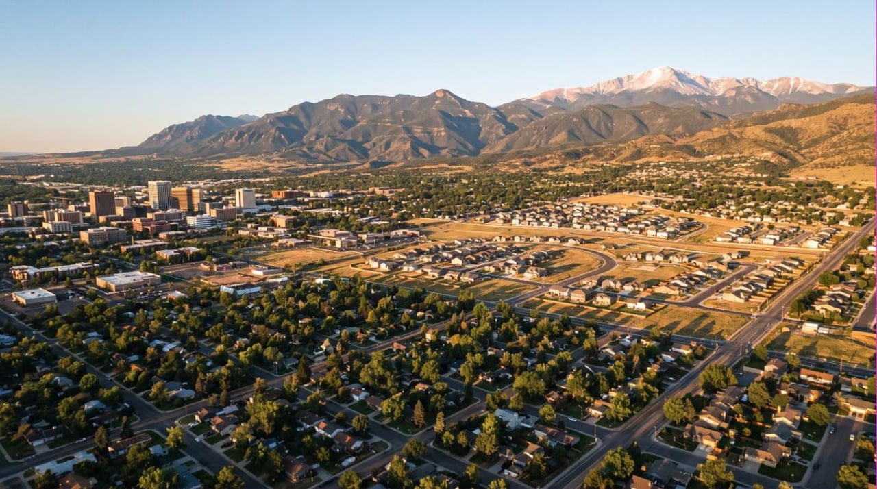
El Paso County covers 2,127 square miles of land. Its single-family median sale price in June 2026 was $499,000. On its own that number tells you close to nothing, because this is not one housing market.
I'm Leah Behr, a REALTOR® with the Behr & Behr Team in Colorado Springs. There is no official list of Colorado Springs neighborhoods. What the county has is about nine working submarkets, separated by four things: how old the houses are, which school district the parcel sits in, which corridor you have to drive, and whether a metropolitan district rides along on the tax bill. This post is the map, not a ranking.
To compare these areas by postal code, use our Colorado Springs ZIP-code and neighborhood reference. It brings neighborhood and school-district context together; verify school assignments for the specific address. You can also browse the full Colorado Springs guide series.
The market baseline, and where the sources disagree
The Local Market Update produced by ShowingTime Plus for the Colorado Association of REALTORS® reports these El Paso County figures for June 2026.
Metric, June 2026 | Single family | Townhouse and condo |
|---|---|---|
Median sales price | $499,000, down 2.0% year over year | $330,000, down 1.5% |
Months supply of inventory | 4.0 | 5.7 |
Days on market until sale | 44, up 18.9% | 53, down 7.0% |
Sources disagree on supply. ShowingTime Plus puts single-family months of supply at 4.0 for June 2026; locally published summaries of the same month have run 3.1 to 3.3. I am not going to average them. The tiebreaker is the price-cut share. Scott Sufak, then president-elect of the Pikes Peak Association of REALTORS® board, told KOAA on June 16, 2026 that 44.2% of active El Paso County listings took a price reduction in May: "the reason that these prices are dropping is because they're priced too high to begin with." PPAR board president Andrea Warner read the June data to KOAA on July 9, 2026 as "a balanced market, which is a very healthy market when it's balanced."
Both are right. Sellers ask too much, then cut.
The nine submarkets, and who each one does not suit
1. Downtown and the historic core
Fillmore Street south to Fountain Creek, I-25 east to Union. The Old North End, Patty Jewett, Shooks Run and Ivywild, all in Colorado Springs School District 11. History Colorado records the Old North End Historic District as listed on the National Register on December 17, 1982, expanded in 2015, covering structures from roughly 1885 to 1965. Does not suit a buyer who needs a level lot or plumbing that has already been replaced.
2. The Westside and the foothills
West of I-25 against the range: Old Colorado City, Mountain Shadows, Peregrine, Rockrimmon, plus Manitou Springs, which has its own District 14. This is the belt the Colorado Geological Survey mapped in Miscellaneous Series 32 in 1999 for steeply dipping heaving bedrock. Does not suit anyone unwilling to pay a structural engineer and shop insurance before going under contract.
3. The Broadmoor and the southwest
South and west of downtown, mostly inside Cheyenne Mountain School District 12, which enrolled about 3,737 students across seven schools in 2024-25. The county's highest sustained prices sit here, and build years run from the 1920s to the 2010s within a few blocks, so two houses at one price can differ by tens of thousands in deferred work.
4. Central and east-central, along Academy
Village Seven, Rustic Hills, the Palmer Park ring, and Cimarron Hills out past Powers. Mostly D11, with District 49 covering most of Cimarron Hills. Housing is largely 1960s through early 1980s, which is why entry prices are the lowest inside the city. Aluminum branch wiring and cast iron drains are common enough that I would not waive a sewer scope.
5. The northwest and the I-25 north corridor
Northgate, Gleneagle, Flying Horse, and north into Monument, Palmer Lake and Woodmoor. Academy District 20 and Lewis-Palmer District 38. Check the tax line: Flying Horse Metropolitan District #2 levied 49.949 mills plus 37.929 of debt service for tax year 2025, per the El Paso County Treasurer's certified levy table. Does not suit anyone commuting to Fort Carson, or anyone who assumed a newer house means a simpler bill.
6. Briargate and the north-central
Briargate, Pine Creek, Cordera, Wolf Ranch, all in Academy District 20. Cordera has no metropolitan district. Part of Wolf Ranch sits in Upper Cottonwood Creek Metropolitan District #5, which levied 77.056 mills for tax year 2025, up from 20.834 in 2023. Same schools, four miles apart. Does not suit anyone shopping on list price alone.
7. The Powers corridor and the far east
Stetson Hills, Springs Ranch, Claremont Ranch and Banning Lewis Ranch, mostly District 49. The city annexed 24,000 acres of Banning Lewis Ranch in 1988, and by the city's own account very little was built there until the annexation agreement was amended in 2018. Hence the newest stock in the county, and the heaviest metro district math: Banning Lewis Ranch Metropolitan District #8 levied 61.321 mills for tax year 2025 and stacks on Regional District #1 at 12.019, for 73.340 mills before the county, city, school district or library take anything. Does not suit anyone working the west side or Fort Carson.
8. Black Forest, Falcon, Peyton and the rural east
District 49 covers Falcon and much of the east, enrolling roughly 20,834 students across 27 schools as of 2025, the tenth largest district in Colorado. Black Forest splits among D38, D20 and D49 depending on the parcel. The Black Forest Fire burned June 11 to 20, 2013 across 14,280 acres; the state after action report headlines 489 homes destroyed, and other counts range from 486 to 511 depending on what is included. Out here you also inherit a well and a septic system.
9. The south: Fountain, Security-Widefield and the Fort Carson side
Widefield District 3, Harrison District 2 and Fountain-Fort Carson District 8 divide this side of the county. The most affordable large submarket carries a water history worth reading first. Firefighting foam used from the 1970s at what is now Peterson Space Force Base contaminated groundwater serving Security Water District, the western portion of Widefield Water and Sanitation District, and Security Mobile Home Park. Wells were taken offline or treated through 2016, and permanent treatment at Aga Park has run since early 2023. Lorson Ranch Metropolitan District #3 levied 76.327 mills for tax year 2025.
School districts, and why I do not rank them here
Boundaries do not follow ZIP codes or city limits. D20 reaches into unincorporated Gleneagle and much of Black Forest, and two houses on one street can sit in different attendance areas. CDE's own district maps say they are "for general reference use only."
The only ratings I point buyers to are the state's own. The Colorado Department of Education assigns districts one of five accreditation ratings under its District Performance Framework. Preliminary ratings publish each September and are finalized in December; 2025 is the most recent framework year published as of August 2026. Look them up on CDE's SchoolView. I do not steer buyers by school district and I will not tell you which is better. Under the federal Fair Housing Act that is not my call.
How to check a specific address, using free public tools
- El Paso County Assessor property record, at assessor.elpasoco.com. Free by address. Year built, assessed value, and the tax area code listing every taxing entity on the parcel. That is how you find a metro district before a lender's disclosure does.
- El Paso County Treasurer tax search. Free. Shows the dollars billed and the certified mill levies behind them. Compare the metro district line to the countywide range of 0.000 to 77.056 mills for tax year 2025. No median is published, so treat a quoted "typical" levy with suspicion. I work the arithmetic in what your Colorado Springs property tax bill really says.
- Pikes Peak Regional Building Department permit and inspection search. Free by address. Permits pulled, inspections passed and failed, and whether foundation work was signed off.
- The district's own boundary locator. Academy District 20 publishes one at boundary.asd20.org. Use the district tool, not a portal's school tab.
- CDE SchoolView for accreditation ratings, FEMA's Flood Map Service Center at msc.fema.gov for the flood zone, and the annual water quality report from whichever utility serves the tap. Here that is not necessarily Colorado Springs Utilities.
What I would do
Pick the corridor first, the district second, the subdivision last. The corridor is the one thing you cannot renovate. Then pull the Assessor and Treasurer records before you fall for the kitchen.
Our post on how to pick your Colorado Springs neighborhood works the tradeoffs one buyer at a time. Weighing a north-county address against the drive? Read what the Colorado Springs versus Denver numbers actually say. Still deciding whether to move? Start with the honest guide to moving here for 2026.
I'm Leah Behr, a REALTOR® with the Behr & Behr Team. I moved to Colorado Springs in 2009 and have spent my career walking buyers through El Paso County, from Manitou Springs east to Peyton and north to Monument. Send me an address and I will pull the Assessor record and the permit history and tell you what I see, including the parts that argue against buying.
General information only, not legal, tax, engineering, insurance or lending advice. I am not an attorney, engineer or tax professional; on soils, septic, water quality and taxes, hire the licensed professional. Market figures are as published on the dates named and change monthly. The Behr & Behr Team does not steer buyers toward or away from any area on the basis of race, color, religion, sex, handicap, familial status or national origin. Equal Housing Opportunity.