Walk Score rates Colorado Springs 36 out of 100. One block of West Colorado Avenue rates 92.
I'm Leah Behr, a REALTOR® with the Behr & Behr Team in Colorado Springs, and the short answer is that four areas here walk: downtown, Old Colorado City, Manitou Springs, and the older grid north and east of Colorado College. The rest of this city was built around a car and does not pretend otherwise.
The citywide 36, and why it tells you almost nothing
Walk Score's Colorado Springs city page, retrieved August 2026, publishes a Walk Score of 36, a Transit Score of 19 and a Bike Score of 45, and sums it up as "Most errands require a car." The city's own PlanCOS page reports a Walkscore of 36 in 2018, 36 in 2019 and 35 in 2020, and a Transitscore frozen at 19, with the caveat that "care should be taken in interpreting the results" because the measure is "primarily based on a calculation of land use proximity." It counts what is near you. It does not know whether the sidewalk exists, and it blends the 1871 townsite with subdivisions fifteen miles east.
Address, Walk Score retrieved August 2026 | Walk | Transit | Bike |
|---|---|---|---|
2510 W Colorado Ave, Old Colorado City | 92, "Walker's Paradise" | 31 | 69 |
306 Cañon Ave, Manitou Springs | 80, "Very Walkable" | not published | 35 |
100 S Tejon St, downtown | 80, "Very Walkable" | 49 | 85 |
1200 N Cascade Ave, Old North End | 69, "Somewhat Walkable" | 46 | 89 |
1034 E Madison St, Patty Jewett | 58, "Somewhat Walkable" | 29 | 74 |
Why the old grid walks and the newer subdivisions do not
This is a platting story and the dates are public. Colorado City was founded August 13, 1859, the first permanent settlement in the region per History Colorado, and annexed into Colorado Springs in 1917. Colorado Springs came twelve years later: per the Colorado Springs Pioneers Museum, the Colorado Springs Company incorporated in May 1871 under William Jackson Palmer, officials "struck the first stake at the corner of Cascade and Pikes Peak avenues" on July 31, 1871, and lots sold the next day. Palmer specified wide, tree-lined streets and planned for electric streetcars.
Anything platted under those rules has what a walkable place needs: short blocks, a connected grid, commercial frontage mixed in rather than pushed to an arterial, and sidewalk on both sides. Post-war Colorado Springs was platted the opposite way: curvilinear collectors, cul-de-sacs, retail at signalized intersections. When a listing in a 1998 subdivision advertises walkability, it usually means a path to a park, not a walk to a grocery store.
Downtown, and the housing that actually arrived
The Downtown Partnership of Colorado Springs State of Downtown 2026 report, released March 2026, counts 712 new multifamily units opened in 2025 and roughly 1,500 more announced. Colorado Public Radio's Dan Boyce reported on March 26, 2026 that the downtown residential population rose from 2,574 in 2024 to 4,860 in 2025, with 37 new businesses.
The Colorado chapter of the American Planning Association named Tejon Street a Great Street in its 2020 Great Places in Colorado program, and Tejon between Boulder Street and Vermijo Avenue is the walk to take. The caveat is groceries. Bread & Butter Market at 602 S Nevada Avenue covers staples, and the Safeway that Safeway itself labels "Downtown" sits at 1920 S Nevada Avenue, a real walk from Bijou Street. Walk that route before you sign. Our post on condo and townhome living in downtown Colorado Springs covers the for-sale inventory.
Old Colorado City, the highest address-level score I found
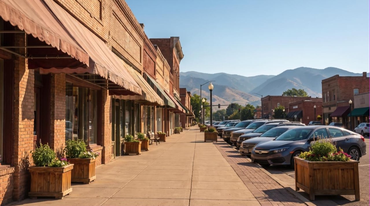
The 92 at 2510 W Colorado Avenue was the highest score I pulled anywhere in El Paso County. Walk Score's neighborhood ranking is more modest, putting Old Colorado City sixth citywide at 57, behind Shooks Run at 72, Knob Hill at 64 and the broader Westside at 63. Both are right, and the gap is the lesson. The commercial spine on Colorado Avenue is exceptional. Six blocks off it you are in a residential grid with a long walk back to anything. Buy the block, not the name. Our post on everyday lifestyle and walkability in Old Colorado City goes street by street there.
Manitou Springs, the altitude and the grade
Manitou is its own municipality, and 306 Cañon Avenue scores 80, "Very Walkable." Walk Score's land-use math disagrees with your legs here: the same address returns a Bike Score of 35. I pulled the elevations below from the USGS 3DEP Elevation Point Query Service in August 2026, and the arithmetic is mine.
Location | Elevation, USGS 3DEP, August 2026 |
|---|---|
Tejon Street and Pikes Peak Avenue, downtown | about 6,010 ft |
25th Street and W Colorado Avenue, Old Colorado City | about 6,076 ft |
Manitou Avenue and Cañon Avenue, Manitou Springs | about 6,356 ft |
Ruxton Avenue near the Cog depot | about 6,583 ft |
The historic core is flatter than its reputation. Downtown to Old Colorado City is roughly 66 feet of rise across about two miles, under 1%. The west end is not. Ruxton Avenue gains roughly 230 feet in about three quarters of a mile off Manitou Avenue, near 5%. A high score on a steep grade is a different daily life than the same score on the flat.
On altitude, the CDC Yellow Book 2026 says an unacclimatized traveler sleeping at or above 8,000 feet, "and sometimes lower," is at risk for altitude illness, and that roughly 25% of visitors sleeping above that mark in Colorado develop acute mountain sickness. Downtown at about 6,010 feet sits under it, so this is a stamina question, not an altitude sickness one. I am not a physician and this is not medical advice.
Transit is the weak link, and the region's own plan says so
The Pikes Peak Area Council of Governments' Colorado Springs 2050 Regional Transit Plan, August 2024, is candid.
- Mountain Metropolitan Transit carried about 2.87 million boardings in 2023, roughly 89% of its 2019 level.
- Four routes offer 15-minute weekday daytime frequency. Most of the rest run 30 to 60 minutes.
- 44% of the urbanized area population lives within a quarter mile of a fixed route. The plan's long-term goal is 90%.
- In September 2023, 5 of 34 routes met the 90% on-time target.
A 30 to 60 minute headway with sub-90% on-time performance works for a commute you can pad, and poorly for a school pickup.
Score the exact address before you commit to the area
- walkscore.com. Enter the full street address, not the neighborhood. The gap between the two is the most informative thing on the page: Patty Jewett returns 58 at the address I checked against a 44 neighborhood average.
- The USGS 3DEP Elevation Point Query Service at epqs.nationalmap.gov. Look up the house and the store. The difference in feet is what no listing photo shows.
- Google Street View, winter imagery if you can get it. Drag down the block both directions and count the sidewalk. Missing segments and absent curb ramps are visible.
- Mountain Metro's route map and trip planner at coloradosprings.gov, plus the trail maps at coloradosprings.gov/legacyloop. Plan the real trip at the real hour, then look at the headway.
- Walk it on a Tuesday at 7:30 a.m. It settles arguments the data cannot.
What I could not confirm
I could not find a published citywide inventory of missing sidewalk mileage. PPACG's Active Transportation Plan notes that "PPRTA 3 purposely allocated significant funding to missing sidewalk and trail system programs," but no source I reached puts a number on the gap. If you see one quoted, ask which document it came from. The city publishes no percent-complete figure for the roughly 10-mile Legacy Loop trail around downtown either. A Gazette headline dated January 15, 2026 reported a new urban grocery heading downtown; I could not open the article to confirm an operator or date, so treat it as announced, not open.
Where I would send a buyer who says walkable
If walkable means leaving the car parked for three days at a stretch, the list is short: the blocks around Tejon Street downtown, the blocks on or one street off West Colorado Avenue, and central Manitou Springs if you accept the grade.
If walkable means a sidewalk grid, street trees, a park on foot and a car you still drive to the store, the Old North End, Patty Jewett, Shooks Run, Knob Hill and Ivywild deliver it at a wider range of prices. And if a listing east of Powers calls itself walkable, ask what the walk is to. Frequently it is a path to a detention pond. For the wider picture, read what it is really like to live in Colorado Springs.
I'm Leah Behr, a REALTOR® with the Behr & Behr Team in Colorado Springs. I would rather walk a block with you at the hour you would actually walk it than send you a score. Send me an address and I will pull the elevation, the headway and the sidewalk imagery.
General information only, not legal, tax, engineering, medical or lending advice. Walk Score, Transit Score and Bike Score are proprietary measures of land use proximity, retrieved August 2026, and they move as businesses open and close. Elevations are from the USGS 3DEP Elevation Point Query Service, approximate to the coordinates queried. Transit figures are as published by the Pikes Peak Area Council of Governments in August 2024. The Behr & Behr Team does not steer buyers toward or away from any area or district on the basis of race, color, religion, sex, handicap, familial status or national origin. Equal Housing Opportunity.